All Things Habitat - Lets talk.....

This is a sample guest message. Register a free account today to become a member! Once signed in, you'll be able to participate on this site by adding your own topics and posts, as well as connect with other members through your own private inbox!

Land Tour at Foggy's Place

Foggy, take that info about your wetland to the Environmental Services office in your county and ask them how to apply for a variance to build your access trail to cross that swamp! Just see what they say if you want to go about it the legal way!
 
I have a friend who is a wetland consultant in St Cloud. I could possibly get you in touch with him if time allows.
 
I talked to my buddy and he had some good information so either give me a call or I can write up a post later. My number is on your pm.
 
Appreciate all the time spent on a review of my land. Almost embarrassed to ask more.....almost. :D

Was doing some looking at wetland classifications. Here is a map of my area. I own gov outlets 3 and 4.....as well as the 40 south of outlet 4. That swamp at the intersection of the "L" is the part in question. It has a Classification of PEM/SS1C in the area I'd like to make a crossing. Any knowledge about that classification is perhaps helpful before I head into the SWCD office.
"PEM" = palustrine emergent wetland, meaning the wetland is inland(i. e. not a tidal wetland) and not part of a lacustrine(lakeshore) or riverine(river slough or backwater) wetland system(i.e. it is a stand alone swamp), primary vegetation is above water. The "SS" =Shrub-Scrub wetland, meaning the primary vegetation consists of a minimum of 30% or more woody plants, such as willows, etc. The "1" = most of your woody plants are of the broad-leafed deciduous variety. And finally the "C" stands for seasonally flooded. Wow, the things you remember from high school forestry class. I did have to do a little research to find out what the 1 stood for.
 
"PEM" = palustrine emergent wetland, meaning the wetland is inland(i. e. not a tidal wetland) and not part of a lacustrine(lakeshore) or riverine(river slough or backwater) wetland system(i.e. it is a stand alone swamp), primary vegetation is above water. The "SS" =Shrub-Scrub wetland, meaning the primary vegetation consists of a minimum of 30% or more woody plants, such as willows, etc. The "1" = most of your woody plants are of the broad-leafed deciduous variety. And finally the "C" stands for seasonally flooded. Wow, the things you remember from high school forestry class. I did have to do a little research to find out what the 1 stood for.

I know 1, is low value wetland, 2 is medium value, 3 is high value. Don't know if that is what this number 1 is for.....maybe?
 
"PEM" = palustrine emergent wetland, meaning the wetland is inland(i. e. not a tidal wetland) and not part of a lacustrine(lakeshore) or riverine(river slough or backwater) wetland system(i.e. it is a stand alone swamp), primary vegetation is above water. The "SS" =Shrub-Scrub wetland, meaning the primary vegetation consists of a minimum of 30% or more woody plants, such as willows, etc. The "1" = most of your woody plants are of the broad-leafed deciduous variety. And finally the "C" stands for seasonally flooded. Wow, the things you remember from high school forestry class. I did have to do a little research to find out what the 1 stood for.
Wow. WTG Wiscwhip. I found and read this classification detail last night on a wetlands site. Your explanation is better than that which I found.....and really depicts my situation well. Armed with the info I have.....and after making a phone call or two to a few members here......I'm need to make a drive up to Walker (45 miles) to the SWCD office and have a chat about what I can do here.
 
foggy, what is the deal with the "gov outlets"? Does this area have "flow" and drain into a river or lake nearby? I would think if it does, it would have to be far enough away to keep the classification as palustrine and not one of the other lacustrine or riverine wetland classifications. If the area has "flow", that may complicate things, as a raised roadbed would restrict that "flow" from one direction or another. They may require that you put in culverts or some such thing to keep the natural "flow" intact.
 
You will have a diminimus exemption with this classification and as long as your under 10,000 sq ft as Jim Timber said you will be exempt from permit requirements. But my buddy said you still have to go through swcd because they will need to determine where your wetland classification ends. You have a lot of leeway in that spot to avoid any penalties or wetland replacement fines. he said your county is very easy to work with. Approach it with the concept of gaining access to your east property without going through your neighbors. They will probably require you to have a cord wood base and thus a floating road to reduce impact on any neighboring properties. I know if needed a consultant could get involved if you run into hang ups and they would charge $1200 to complete a plan. I probably missed some of the conversation I had with him but that was the gist of it.
 
^ Thanks guys. THere is no inlet our oulet to this swamp....and no water flows anywhere. The water table here just vvaries somehwat due to rainfalls.....and then just by a few inches in water depth.

Good info here Riggs....and I think I'm headed in he right direction here. I'm gonna call you.....but I gotta finish a few other things first. Damn.....priorities. ;)
 
Don't worry about calling me but my buddy said he could talk to you if you have any problems in the process. I can get you his contact info if you need it.
 
"PEM" = palustrine emergent wetland, meaning the wetland is inland(i. e. not a tidal wetland) and not part of a lacustrine(lakeshore) or riverine(river slough or backwater) wetland system(i.e. it is a stand alone swamp), primary vegetation is above water. The "SS" =Shrub-Scrub wetland, meaning the primary vegetation consists of a minimum of 30% or more woody plants, such as willows, etc. The "1" = most of your woody plants are of the broad-leafed deciduous variety. And finally the "C" stands for seasonally flooded. Wow, the things you remember from high school forestry class. I did have to do a little research to find out what the 1 stood for.
The deal with Gov't "outlets" is that its just a legal description for the property. (Kinda like the NW 1/4 of Parcel XYZ) Those Gov "Outlots" may have gotten some extra survey work as they are the "adjustments" for the area due to the earth being round (they are both a bit less than 40 acres).....and also intersect with another county, which is just across my property line. I do not think they have anything to do with water. This swamp has no flowing water to anything.

It's really been helpful to me to understand some of this wetland classification stuff. Looks like I have anticipated a problem that should not be that difficult to overcome if I go through the right channels. It could be a real "game changer' for my land.......and at a minimum it will keep me busy for the next few seasons. I feel certain it would benefit my property and the wildlife of the area.

On my land tour I never really took anyone over to a different area to the north....where two points come closely together (as shown on the map above). At this location, the water is only 100 feet (or less) across the swamp.....as a long finger of dry land goes nearly across (originating behind my shed). I may try to connect BOTH areas to the other side at these narrow spots. (MORE TRAILS! ;) )
 
Foggy, Don't get a false hope that any work you plan on doing will fly through the system and get approved. The Soil and water office will just send you to your County Environmental Services office, That is where the chick behind that desk can make or break anything you are planning on. Good Luck and let us know what they say.
 
The diminimus is a one time per property exemption. So if your planning multiple things you need to know this.
 
The deal with Gov't "outlets" is that its just a legal description for the property. (Kinda like the NW 1/4 of Parcel XYZ) Those Gov "Outlots" may have gotten some extra survey work as they are the "adjustments" for the area due to the earth being round (they are both a bit less than 40 acres).....and also intersect with another county, which is just across my property line. I do not think they have anything to do with water. This swamp has no flowing water to anything.

It's really been helpful to me to understand some of this wetland classification stuff. Looks like I have anticipated a problem that should not be that difficult to overcome if I go through the right channels. It could be a real "game changer' for my land.......and at a minimum it will keep me busy for the next few seasons. I feel certain it would benefit my property and the wildlife of the area.

On my land tour I never really took anyone over to a different area to the north....where two points come closely together (as shown on the map above). At this location, the water is only 100 feet (or less) across the swamp.....as a long finger of dry land goes nearly across (originating behind my shed). I may try to connect BOTH areas to the other side at these narrow spots. (MORE TRAILS! ;) )
Sorry there foggy, "outlots" makes sense, it was when I read "outlets" in that other post that made me think of the "flow" of the water in that marsh. We have Government outlots in the area I hunt, in an area with a huge marsh very much like what you have, with no natural outlets. The reason for them in that area is not the curve of the earth adjustment, it is because the Federal Government actually owns the "marsh" area and the adjacent landowners only own up to the edges, thus the "extra surveying" you spoke of. I believe at one time the Government had wanted this marsh as a Waterfowl Production Area, but after they took it over they found out that only minimal nesting occurred there each year due to the water being overly acidic from the breakdown of organic matter throughout the marsh, oak tannins leaching in from the south and east woods and the acids that are leached from the huge pine plantations on the west and north sides of the marsh. Many of the microorganisms that feed the invertebrates that in turn feed the ducks and geese won't live in that water due to the increased acidity of the water, which limits the food supply for waterfowl broods.
 
Before you make the drive - call them! They'll want a boots on the ground assessment before they make a decision, and site visits for land owners are usually free.
 
The Regulations are the easy part, The determination you get is what can make or break you!
 
Sounds like everyone had a good time and Foggy got far more help than he could have imagined with his swamp issue. See what happens when you put some like minded folks together. If we all lived in the same area can you imagine the impact we would have? It would be down right scary. Sorry I couldn't make it - WAY to far for me, that's what I get hangin out with you guys from the Nort!
 
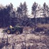
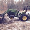
Spent a few hours implementing part of the plans from the land tour the other day. Cleaning up a bunch of timber from my log landing and putting the logs and slash on piles. Gonna plant some corn and beans here this summer. Much better doing this work in the winter than in summer. Got my burning permit today.....and as soon as we get a bit more snow I am going to fire-up those piles of timber.

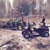
Made about 4 big piles to burn before turning a tire off my rim for about the tenth time. Took the tire into the tire store and (finally) had them put a tube in it. Thought I'd take a few pics of the process. Note how handy the Golf Cart comes in as a service vehicle. Beats walking with a tire. ;)
grapple.jpg tire.jpg cart.jpg

Just like Rosanne, Rosanna, Dana, Sez : "It's always sum thing".
 
Nice Foggy, you can't keep a good man down. I bet you were just having to much fun and that tire couldn't keep up, it looks great.

Theres another reason to have a golf cart, maintenance of any kind.

Looks like were going to have a warm up this week, a good time to have some fun with the big toys. Enjoy!
 
Top